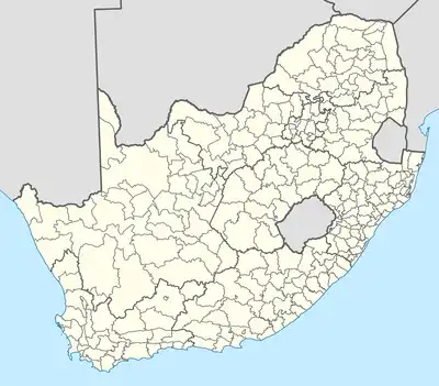
How Many Provinces Are there In South Africa?

South Africa has nine provinces, and they range widely in size. In contrast to Gauteng, the country’s most crowded area, which is small and highly inhabited, the Northern Cape, which makes up roughly a third of the country’s land, is mainly vacant, dismal, and desert. Each province has a separate executive council, premier, and legislature. Zimbabwe, Namibia, and Botswana are its neighbors; Mozambique and Eswatini are to the northeast.
Lesotho’s mountain kingdom is surrounded by South African territory in the southeast.
There are three capitals in South Africa:
The country’s Parliament is located in Cape Town, the legislative capital, which is part of the City of Cape Town metropolitan municipality in the Western Cape.
The Supreme Court of Appeal is located in Bloemfontein, the judicial center of the Free State, which is a part of the Mangaung Metropolitan Municipality.
The nation’s administrative and final capital is Pretoria, located in the Gauteng province’s City of Tshwane metropolitan municipality. The Union Buildings and a sizable component of the Public Service are located there.
The South African Provinces Include:
Eastern Cape
The Eastern Cape, located on the southernmost South African coast, is a place of outstanding natural beauty, especially the Wild Coast’s craggy cliffs, choppy waters, and lush green vegetation.
Free State
The Free State is a province in central South Africa with expansive vistas, clear sky, farms, mountains, goldfields, and isolated settlements. Manufacturing is the second largest employment after mining, notably gold mining.
Gauteng
This is the least populous of South Africa’s nine provinces yet has the most excellent population density. The most significant economic sectors are commerce, logistics, manufacturing, real estate, and financial and business services.
KwaZulu-Natal
The province with the second-largest population also happens to be one of the most well-liked vacation spots in the nation. The lush subtropical east coast of South Africa is part of this luxuriant area. It extends from Port Edward in the south and north to the border with Mozambique, being swept by the warm Indian Ocean.
Limpopo
The northernmost province of South Africa has borders with Mozambique, Zimbabwe, and Botswana, making it the best point of entry into Africa. The province, which takes its name from the Limpopo River, which borders it on the north, is home to an abundance of animals, breathtaking landscape, and historical and cultural riches.
Mpumalanga
It’s name means the spot where the sun rises. The province is among the most popular travel destinations in South Africa because of its breathtaking natural beauty and abundance of animals. Most of Mpumalanga is located in the Grassland Biome. Between this grassland region and the Savanna Biome, the escarpment and the Lowveld provide a transitional zone.
Northern Cape
This is South Africa’s biggest province, making up 31% of its total land area (slightly bigger than Germany). The Northern Cape, however, continues to have the lowest population density in South Africa.
North West
This province is found in north South Africa, close to the Botswana border. It is bordered to the west by the Kalahari Desert, to the east by Gauteng, and to the south by the Free State. Some of the tourism destinations are Sun City, the Pilanesberg National Park, the Madikwe Game Reserve, the Cradle of Humanity Site, the Taung Heritage Site, the De Wildt Cheetah and Wildlife Trust, and the Lesedi Cultural Village.
Western Cape
The Western Cape, located on the southwest coast of Africa, is a well-known tourist destination due to its expansive beaches, magnificent landscape, and great diversity of cultures, historical sites, top-notch restaurants, and entertainment.
Share This


